Images courtesy of the USDA-FSA-APFO National Agricultural Image Program
Nicholas Ketchum
Deputy Editor
In 1956, the area between Ann Arbor and Ypsilanti was not much—but not for much longer.
After the two world wars, Ann Arbor-Ypsilanti growth quickly accelerated, partly due to a fast-growing economy, a baby boom, and federally-subsidized suburban development encouraged by widespread automobile ownership, to name only a few reasons.
We can get a glimpse into how this region has grown, especially around the area of the current-day WCC campus. How? Aerial survey photos are one way.
The United States Geological Survey’s (USGS) “Earth Explorer” at earthexplorer.usgs.gov offers an interactive map that allows users to view historical aerial imagery, which has been donated (and without the usual restrictions or copyrights) to the USGS.
Full-size image downloads are available for many dates and areas after creating a free account on the usgs.gov website.
Here are some of the historical photos from the USGS of campus and the surrounding area that document the region’s growth.
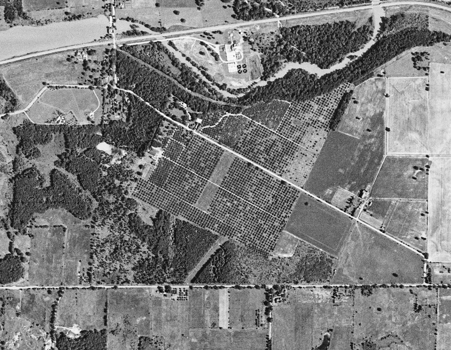
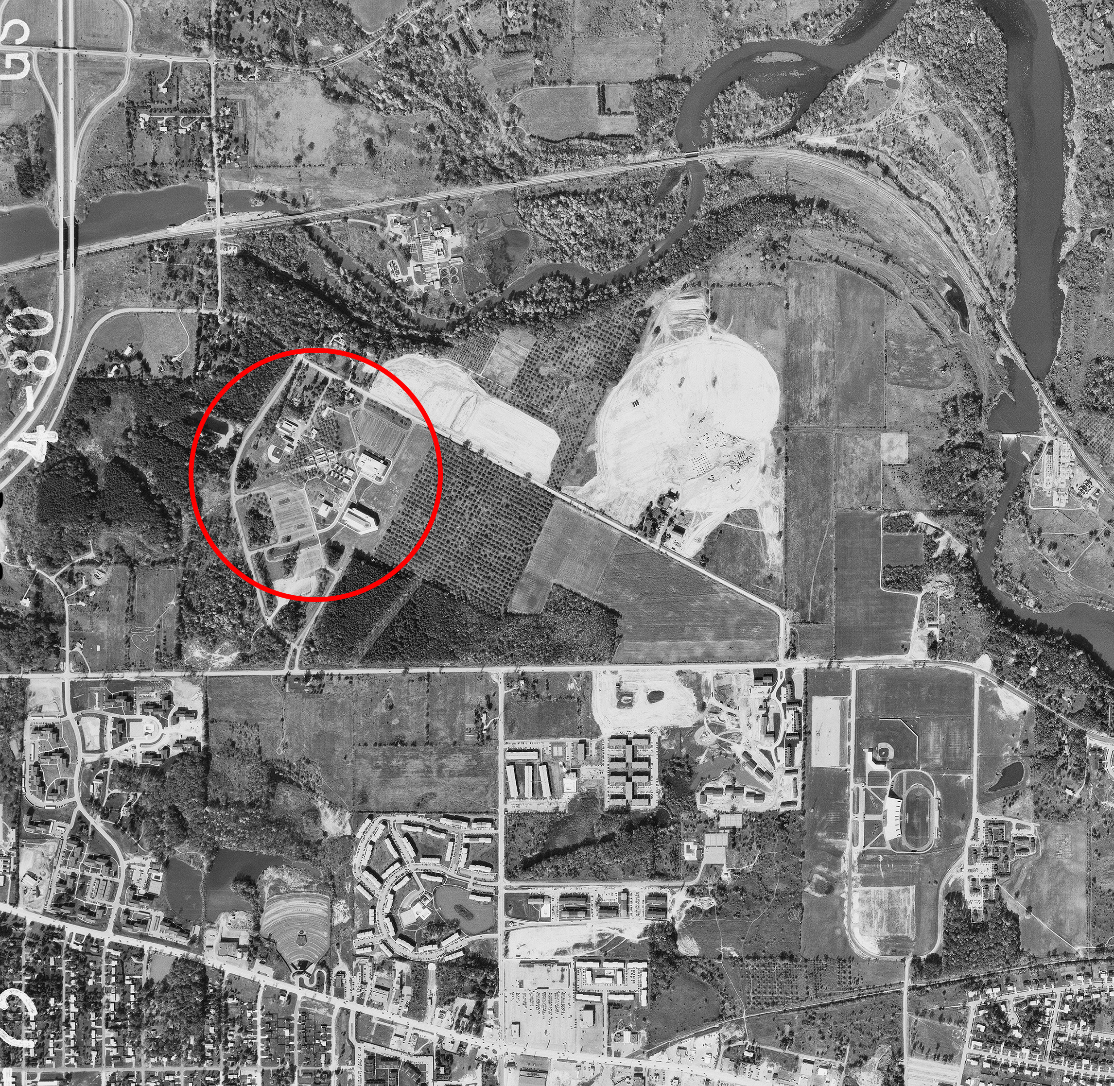
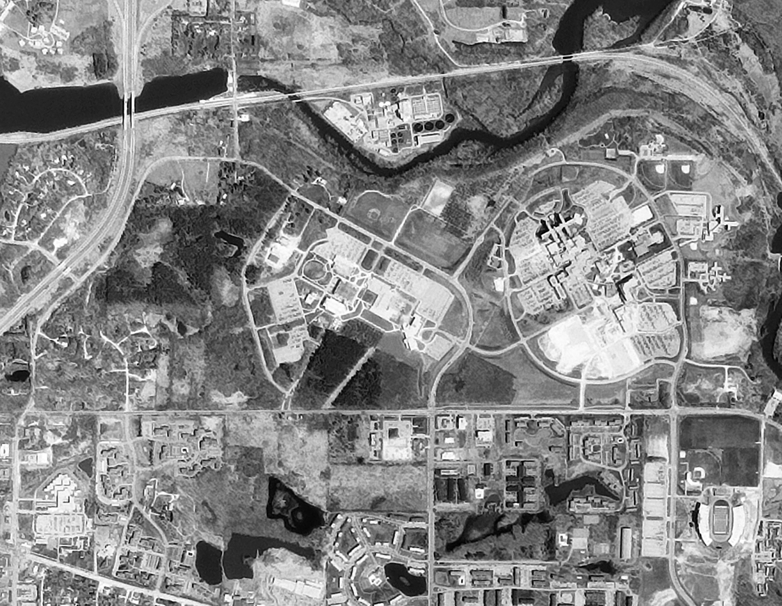
1956 – An orchard at peace.
WCC grounds are an orchard of apple trees, which crosses East Huron River Drive and reaches on to the south bank of the Huron River.
High-tension power lines still travel through the orchard exactly where they do today, where the larger trees in the small wood have been cut at a diagonal to Clark Rd.
The modern St. Joseph Mercy Hospital has yet to be moved to the location across the street.
U.S. 23 has yet to be built.
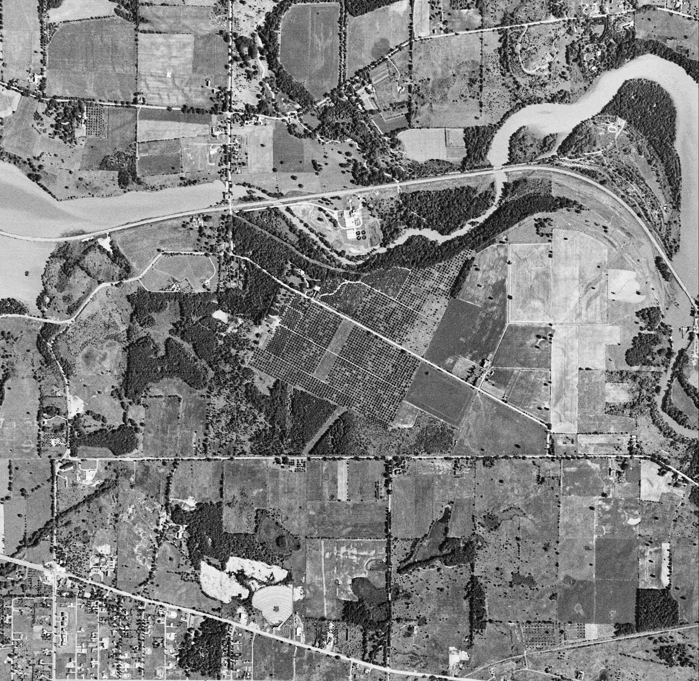
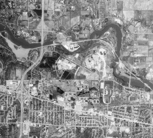
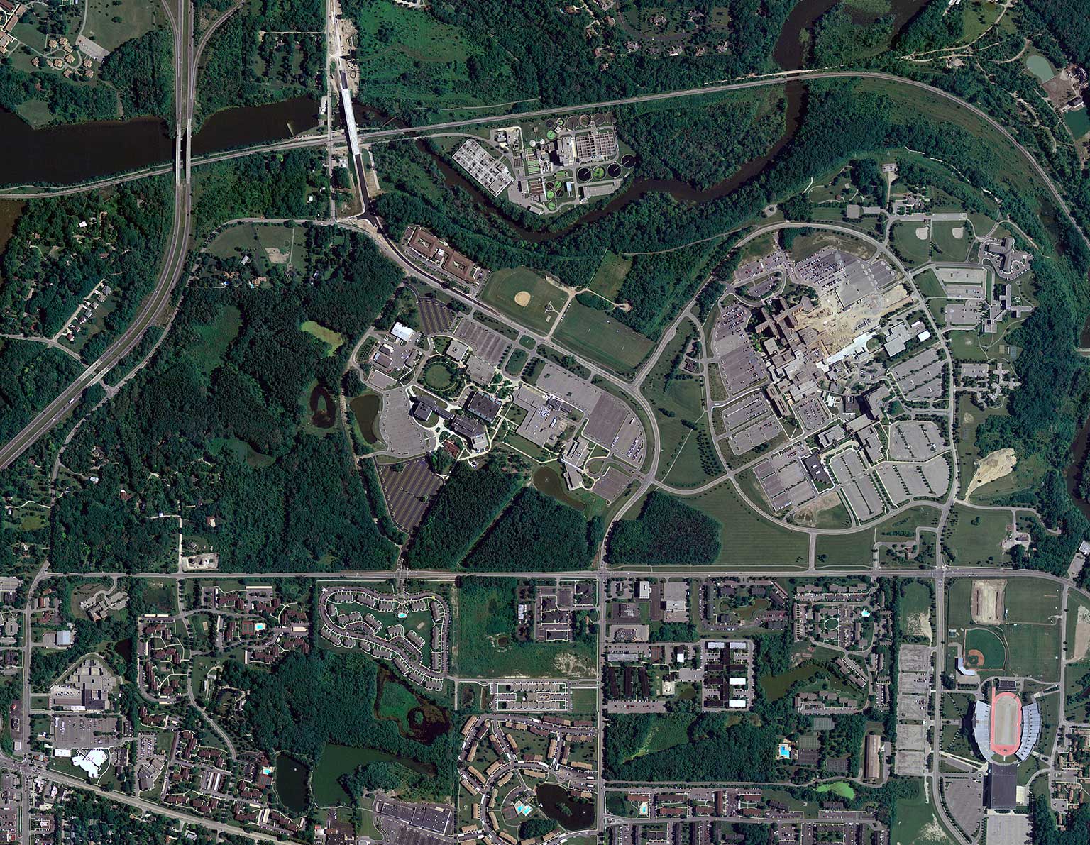
1973 – A fresh WCC campus suddenly appears. (Slide to the left)
Suddenly there’s a college campus! The Crane Liberal Arts and Science as well as the Technical and Industrial buildings are in-place, along with parking and some miscellaneous structures. Much of the orchard remains to the east.
The plot that currently is the site of the Fitness Center is being cleared of the orchard.
Unlike today, an access road had been cut clean along the west side of campus.
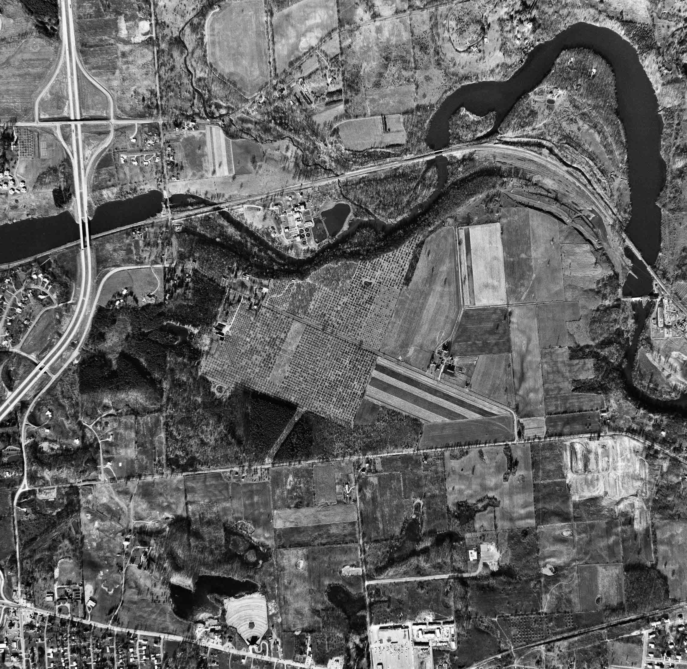
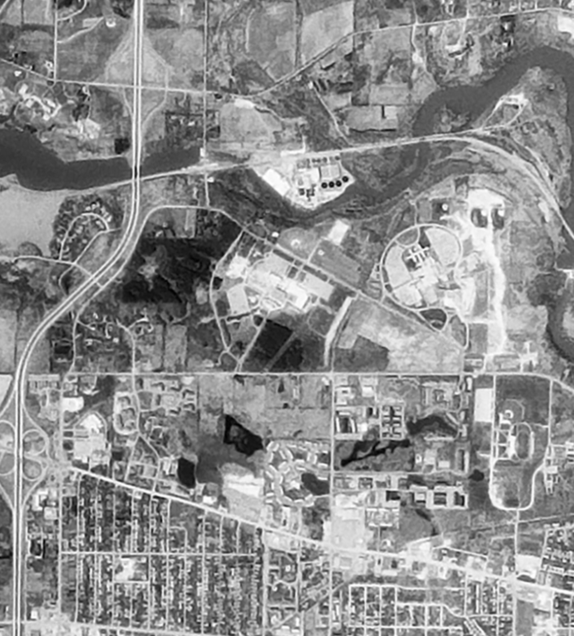
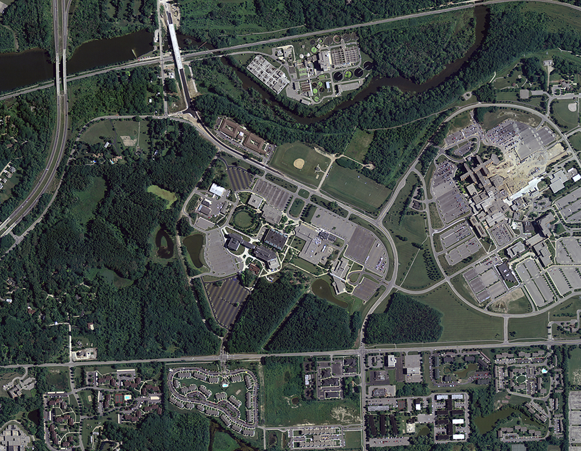
1983. Additional buildings such as the Student Center and Occupational Education buildings are visible. Images courtesy of the USDA-FSA-APFO National Agricultural Image Program
1983 – The campus advances further into the orchard.
The Student Center and Occupational Education buildings have been built.
The current-day Fitness Center site appears to contain at least a baseball field.
Barely visible is an up-and-running St. Joseph Mercy Hospital.
Very little of the original orchard remains. Just a Y-shaped area of orchard stands at the east boundary.
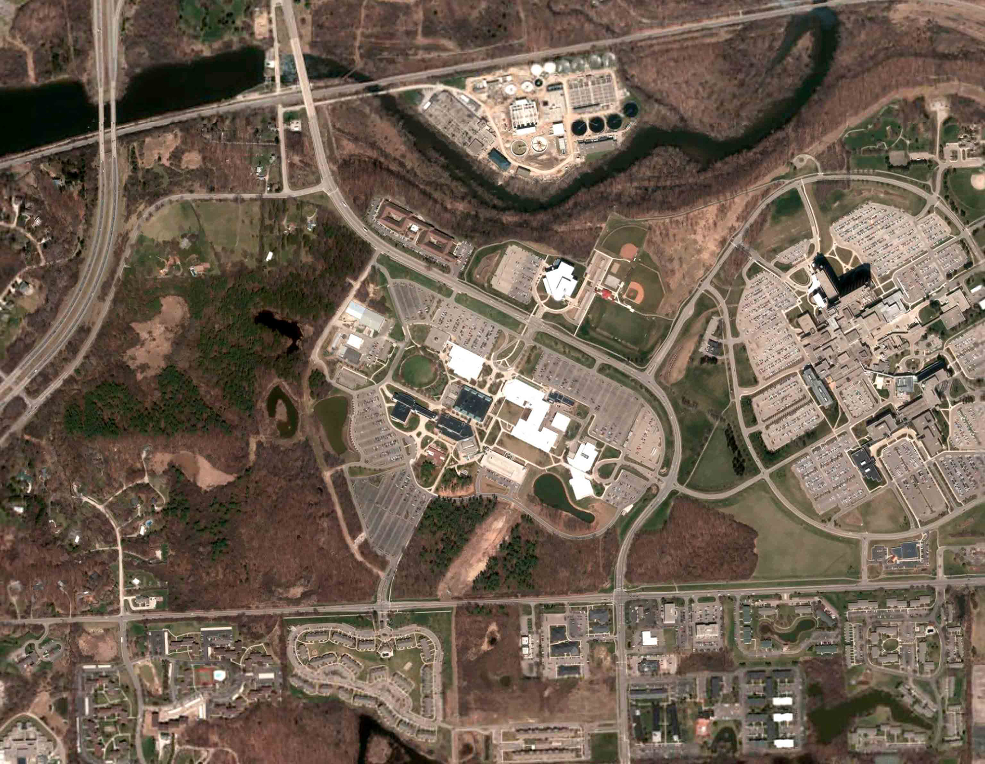
Campus remains relatively unchanged from 1983.
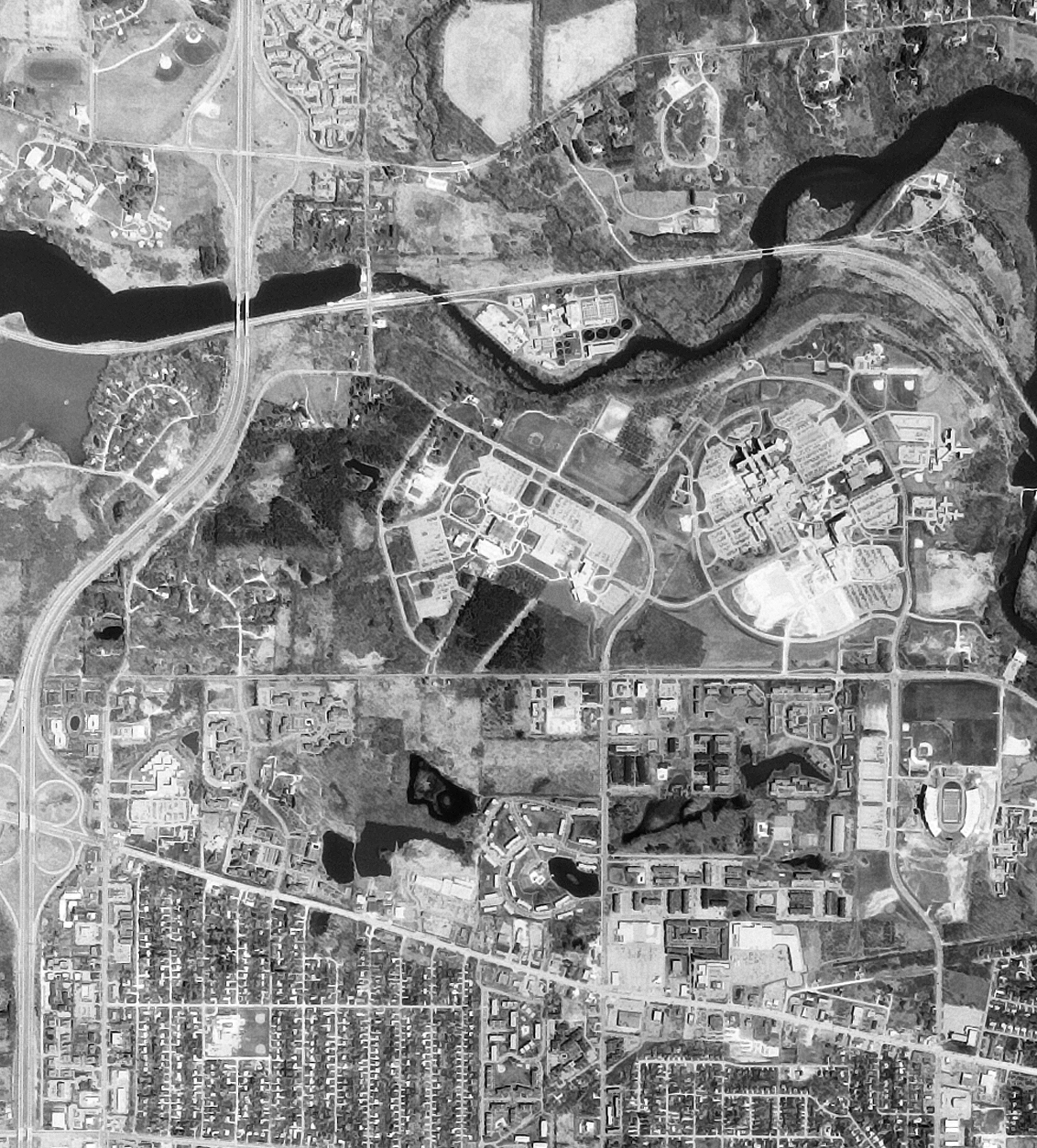
1993 – No more orchard.
The Morris Lawrence building is built.
More parking is poured, especially for Morris Lawrence.
More orchard is removed—seems the last remaining patch of orchard is at the site of the current parking structure.
The Art and Sciences building addition is under construction.
More parking has been added in the northwest.
A water retention pond has been dug behind the Morris Lawrence building.
2005 – A thick, tall, and burly woodland overlooks campus.
The Business Education building has been constructed.
The Gunder Myran building has been constructed.
The Fitness Center still is yet to be built.
A water retention pond has been dug next to Parking Lot #6 on the west side of campus, with the parking lot boundaries altered to accommodate the new pond.
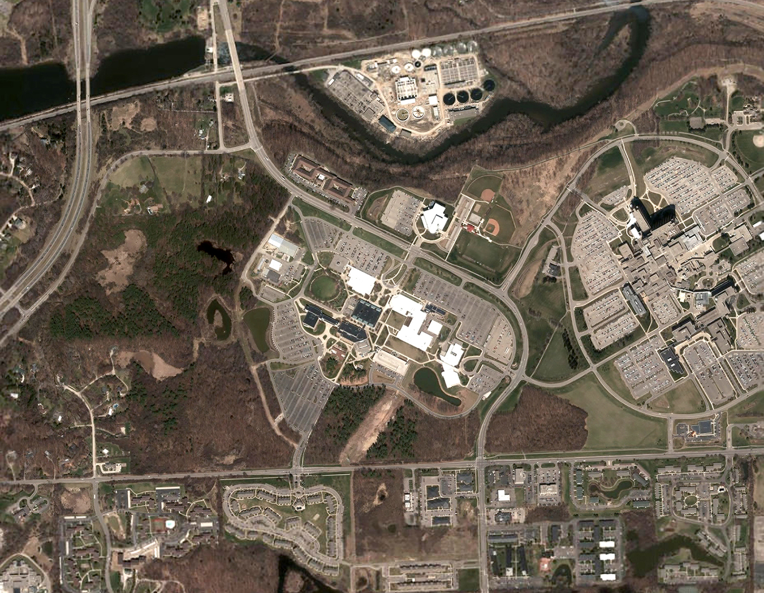
2018 – Campus buildings leap across the street.
The Fitness Center has popped into existence across Huron River Drive.
The west access road has been removed to make way for a trail.
A new access road is cut along the southeast portion of campus, leading to the Morris Lawrence Building.